GeoAI for Agriculture
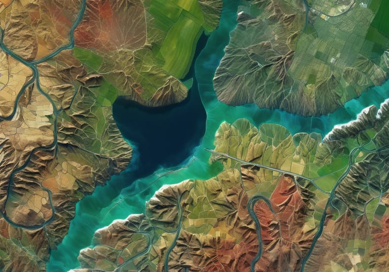
Microwave Remote Sensing (SAR)
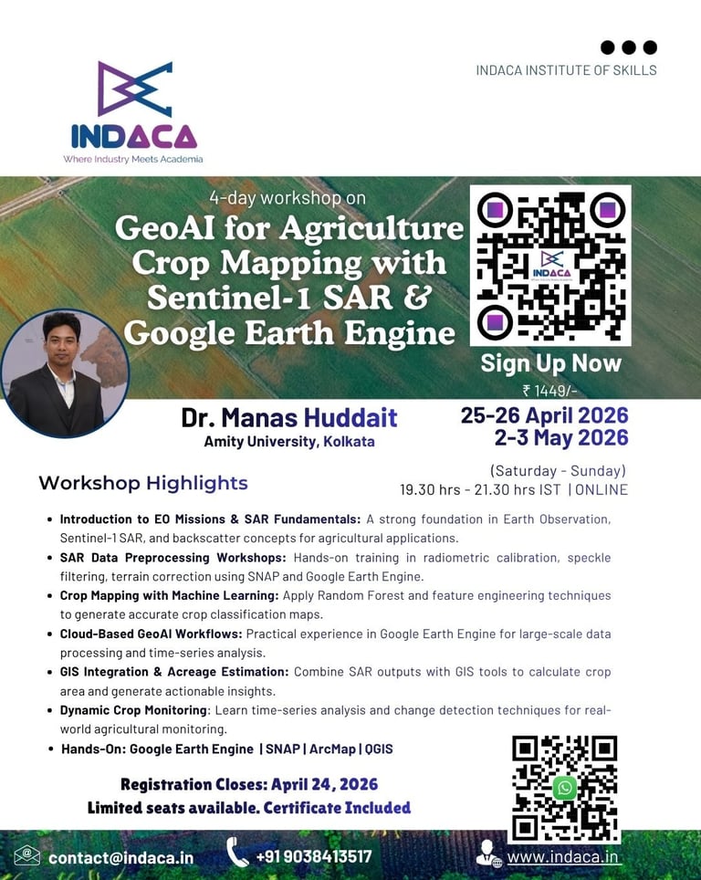
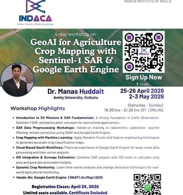
Join 4 day Workshop on GeoAI for Agriculture: Crop Mapping with Sentinel-1 SAR & Google Earth Engine
Dates: April 25-26 & May 2 - 3, 2026
Time: 7:30 PM - 9:30 PM IST
Instructor: Dr. Manas Hudait, Amity University, Kolkata
Save hours of research time, boost success with our workshop on microwave remote sensing for agriculture!
Are you a researcher or project manager in the agricultural sector? Struggling to keep up with the latest in remote sensing technology? Save your time and find solutions to all your problems in one comprehensive package!
Boost Project Success
Guaranteed results with our workshop on microwave remote sensing for agriculture, even without prior knowledge.
Save Research Time
Save hours of research time and find solutions with our workshop on microwave remote sensing.
Save Time and Find Solutions
Project Success Guaranteed


WHAT IF I TOLD YOU...
You can harness the power of Microwave Remote Sensing (SAR) for agriculture to save hours of research time, streamline your projects, and achieve unparalleled success—without needing any prior knowledge or experience!
You'll Gain:
Introduction to EO Missions & SAR Fundamentals: A strong foundation in Earth Observation, Sentinel-1 SAR, and backscatter concepts for agricultural applications.
SAR Data Preprocessing Workshops: Hands-on training in radiometric calibration, speckle filtering, terrain correction using SNAP and Google Earth Engine.
Crop Mapping with Machine Learning: Apply Random Forest and feature engineering techniques to generate accurate crop classification maps.
Cloud-Based GeoAI Workflows: Practical experience in Google Earth Engine for large-scale data processing and time-series analysis.
GIS Integration & Acreage Estimation: Combine SAR outputs with GIS tools to calculate crop area and generate actionable insights.
Dynamic Crop Monitoring: Learn time-series analysis and change detection techniques for real-world agricultural monitoring.
Do not miss if you are:
Agricultural Researchers & Scientists: Looking to deepen understanding and application of SAR.
Project Managers: Seeking to enhance project outcomes with cutting-edge remote sensing techniques.
Students & Academics: Interested in practical, hands-on experience with SAR technology.
Industry Professionals: Aiming to leverage SAR for improved agricultural management and decision-making.
Why Choose INDACA?
Benefits:
Recognized Certification: Validate your expertise in SAR analysis with a certification.
Session Recordings Access: Revisit workshop sessions for 1 year post-training.
Post-Workshop Support: Receive 3 months of dedicated support for your queries and project assistance.
Affordable Registration Fee: INR 1449/- (or USD 20/-) ensures accessible education for all.
The training on SAR data for crop mapping was highly informative and engaging. The trainers were knowledgeable and provided clear explanations. The practical examples and case studies helped me understand the potential of SAR technology in agriculture. Overall, it was a valuable learning experience
Baye Terefe, Injibara University


★★★★★
Overall The workshop was best. The guest lecturer Dr. Manas has explained the things very well and in easiest way possible. A big applause for the host team who have arrange all the related stuffs and essentials in an efficient manner -
Aniket Sharma, National Institute of Technology Raipur
★★★★★
Course conducted was very nice and satisfied, sir Manas has explained the content very well, understandable, thanks to indaca for offering this course. The coordinator was sweet to talk and understanding
Shivani Sawant Dessai, Parvatibai College of Arts and Science, Margao Goa
★★★★★
Contact Us


Have questions about our workshop? Contact us today for more information and to register!
contact@indaca.in
Socials
Subscribe to our newsletter
Copyright © 2025 Indaca Institute of Skills, All rights are reserved
WhatsApp: (+91) 9038413517
Call: (+91) 7439308037