

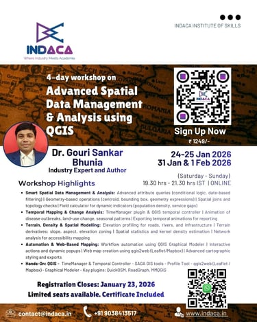
Advanced Spatial Data Management & Analysis using QGIS
If you’re serious about upgrading your GIS skills and applying QGIS confidently in real projects, this is the workshop you shouldn’t miss. Secure your spot before registrations close!
Dates: 24–25 January & 31 January–1 February 2026
Time: 7:30 PM –9:30 PM IST | Saturday and Sunday
Instructor: Dr. Gouri Sankar Bhunia, Industry Expert with 17+ years experience of geospatial technology
Organized by: Indaca Institute of Skills
Registration Closes: Jan 23, 2026
Mode: Online (via Zoom) - English
Advanced Spatial Data Management & Analysis using QGIS
This hands-on workshop is designed to help participants move beyond basic GIS and confidently apply QGIS for real-world spatial problem solving. Through practical demonstrations and use-case-driven exercises, participants will learn how to analyze spatial patterns, visualize temporal change, automate workflows, and publish interactive web maps using open-source tools. The course bridges the gap between theory and application, making GIS skills immediately usable in academic, professional, and project-based contexts.
Course Highlights
Advanced spatial data cleaning, transformation, and enrichment
Attribute- and geometry-based queries and spatial joins
Temporal mapping and animation of dynamic phenomena
Terrain analysis, density mapping, and spatial statistics
Network analysis for accessibility and service planning
Workflow automation using QGIS Model Builder
Creation of interactive web maps for sharing insights
Real datasets from health, urban, agriculture, and environment domains


Who Should Enroll
Students & research scholars in Geography, GIS, Remote Sensing
Professionals in Urban Planning, Health, Environment, Agriculture
NGO and development sector practitioners
Government & consulting professionals working with spatial data
Anyone with basic QGIS knowledge looking to advance their skills


Course Highlights
Advanced Spatial Data Cleaning, Transformation & Enrichment: Learn how to prepare real-world spatial datasets for analysis by correcting geometry errors, resolving topology issues, transforming coordinate systems, and enriching layers with derived indicators. Participants will work with messy, real-life data and convert it into analysis-ready GIS datasets.
Attribute- & Geometry-Based Queries with Spatial Joins: Master advanced querying techniques using attribute logic, expressions, and geometry-based conditions. You will perform spatial joins to integrate multiple datasets such as population, facilities, land parcels, and administrative boundaries—essential for planning and decision-making workflows.
Temporal Mapping & Animation of Dynamic Phenomena: Explore how to visualize and analyze change over time using temporal datasets. Learn to animate disease outbreaks, land-use transitions, rainfall trends, crop cycles, and urban expansion using TimeManager and QGIS temporal tools, and export animations for reports and presentations.
Terrain Analysis, Density Mapping & Spatial Statistics: Develop skills in terrain modelling using DEMs to derive slope, aspect, elevation zones, and terrain profiles. Apply kernel density estimation and spatial statistics to identify hotspots, clustering, and spatial patterns relevant to environmental monitoring, crime analysis, and public health studies.
Network Analysis for Accessibility & Service Planning: Perform network-based spatial analysis to calculate shortest paths, service catchments, and nearest facility access. These techniques are critical for planning schools, hospitals, emergency services, transportation networks, and infrastructure development.
Workflow Automation Using QGIS Model Builder: Learn to automate repetitive GIS tasks by designing graphical workflows that chain multiple operations such as buffering, clipping, overlay analysis, and statistical summarization. This improves efficiency, reproducibility, and consistency in professional GIS projects.
Creation of Interactive Web Maps for Sharing Insights: Transform GIS outputs into interactive, web-ready maps using qgis2web. Learn to publish maps with dynamic layers, pop-ups, legends, and interactivity suitable for dashboards, NGO reports, project websites, and stakeholder communication.

Frequently Asked Questions
What is the workshop about?
The workshop focuses on advanced QGIS significant for various analytical tools.
What tools will be covered?
What is the course duration?
Is this workshop beginner-friendly?
Yes, the workshop is designed for beginners to intermediate participants.
Participants will gain hands-on experience with QGIS (latest stable version), Processing Toolbox & Field Calculator, TimeManager & Temporal Controller, SAGA GIS tools, Profile Tool, qgis2web (Leaflet / Mapbox), Graphical Modeler, Key plugins: QuickOSM, RoadGraph, MMQGIS
The course runs on Jan 24-25 and Jan 31 and Feb 1, 2026, from 7.30 –9.30 PM IST.

Contact Us
Get in touch for workshop inquiries and registration.
Advanced Spatial Data Management & Analysis using QGIS
If you’re serious about upgrading your GIS skills and applying QGIS confidently in real projects, this is the workshop you shouldn’t miss. Secure your spot before registrations close!
Registration Closes: Jan 23, 2026
contact@indaca.in
Socials
Subscribe to our newsletter
Copyright © 2025 Indaca Institute of Skills, All rights are reserved
WhatsApp: (+91) 9038413517
Call: (+91) 7439308037