

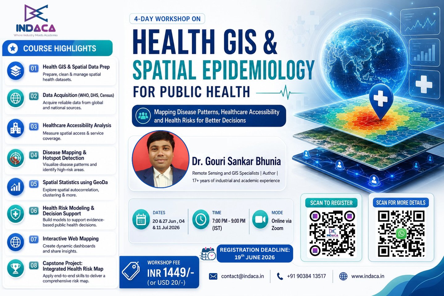
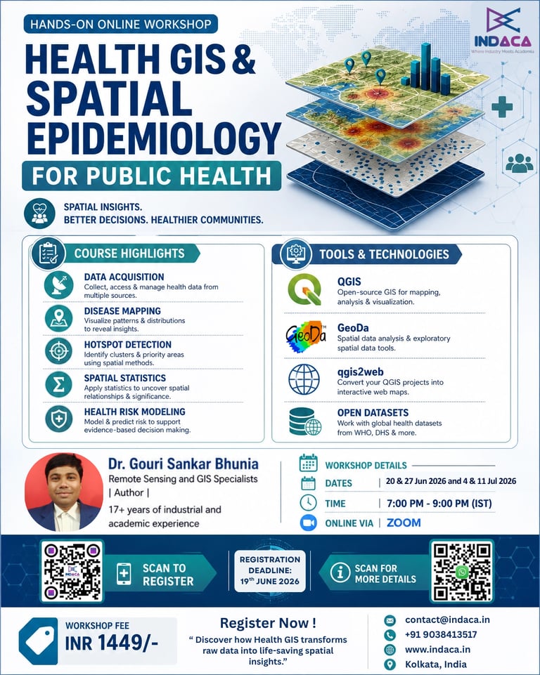
Health GIS & Spatial Epidemiology for Public Health
Unlock spatial solutions for public health research, disease tracking, and epidemiological modeling with our workshop.
Dates: 20 & 27 Jun 2026 and 4 & 11 July 2026 (Weekends)
Timings: 7:00 PM – 9:00 PM IST
Instructor: Dr. Gouri Sankar Bhunia, Remote Sensing and GIS Specialists | 17+ years of industrial and academic experience and Springer Author on Geospatial Analysis of Public Health (Springer 2018) and GeoComputation and Public Health: A Spatial Approach (Springer 2021)
Empowering Public Health Researcher
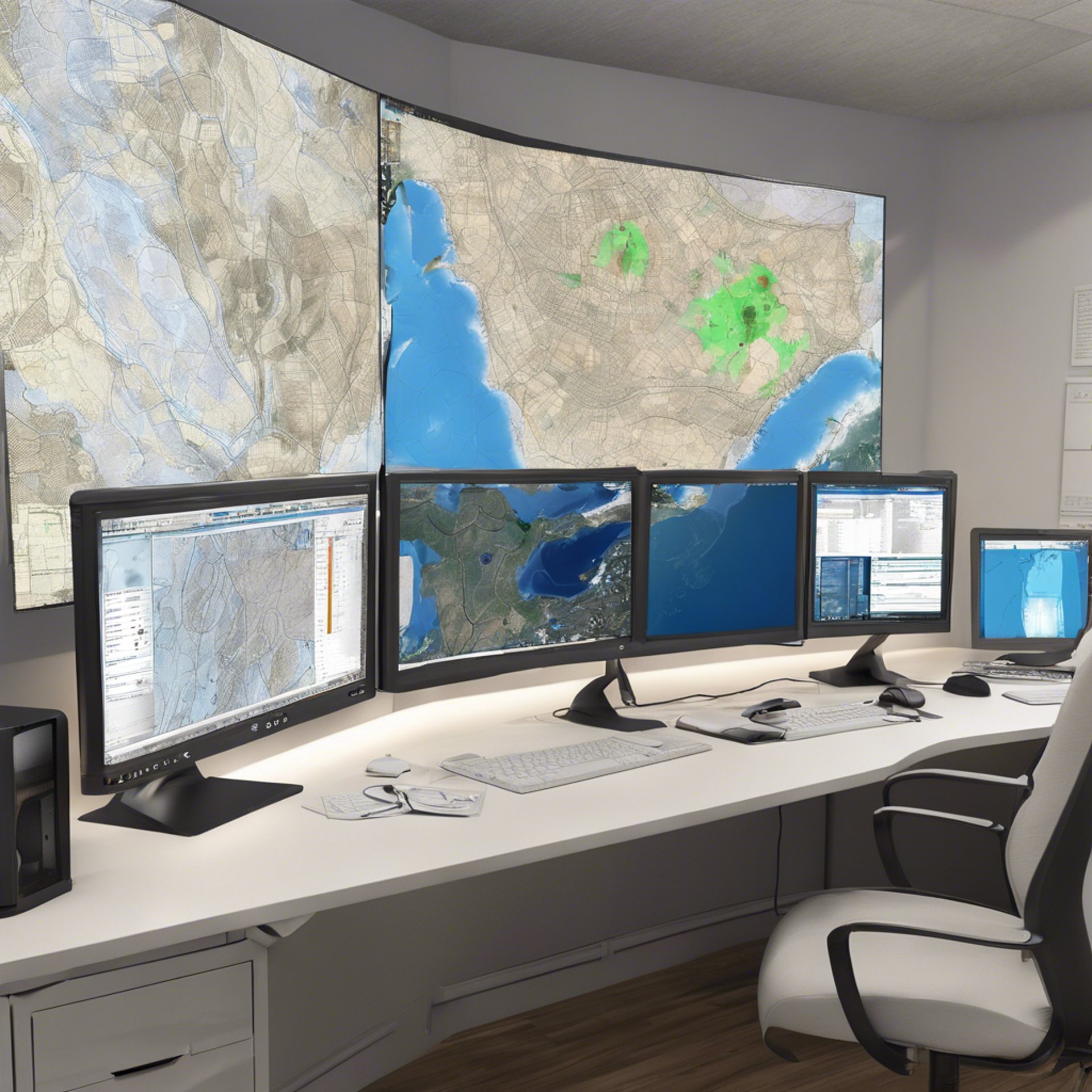
Health outcomes are influenced by where people live, work, and access healthcare services. Health GIS enables researchers and practitioners to analyze disease patterns, healthcare accessibility, environmental health risks, and population vulnerabilities through spatial analysis. This hands-on workshop introduces participants to Health GIS and Spatial Epidemiology using open-source tools and real-world datasets. Participants will learn how to map health indicators, assess healthcare accessibility, identify disease hotspots, perform spatial statistical analyses, and create decision-support maps for research and policy applications.
What You’ll Learn:
Introduction to Health GIS & Spatial Data Preparation: Understanding Health GIS | Applications in Public Health Research | Healthcare Planning and Disease Surveillance | Health Equity and Spatial Thinking
Data Acquisition & Preparation: Installing and Setting Up QGIS | Sources of Open Health Datasets | WHO, DHS, Census and OpenStreetMap Data | Importing, Cleaning and Managing Health Data | Practical Exercise: Mapping Healthcare Facilities | Disease Cases and Administrative Boundaries
Healthcare Accessibility & Service Coverage Analysis: Understanding Healthcare Access - Measuring Accessibility to Healthcare Services | Healthcare Catchment Areas | Identifying Underserved Populations
Spatial Analysis Techniques: Buffer Analysis | Proximity Analysis | Population Coverage Assessment | Network vs Euclidean Distance | Practical Exercise - Develop a healthcare accessibility map for a selected region.
Disease Mapping & Spatial Epidemiology: Disease Pattern Analysis - Thematic Mapping of Health Indicators | Disease Distribution Mapping | Disease Hotspot Identification
Spatial Statistics Using GeoDa: Kernel Density Estimation | Moran's I | Local Moran's I (LISA) | Spatial Autocorrelation | Practical Exercise: Detect and interpret disease clusters using real-world datasets.
Health Risk Modeling & Decision Support: Health Risk Assessment - Environmental and Socioeconomic Determinants of Health | Population Vulnerability Mapping | Multi-Criteria Health Risk Analysis
Communicating Results - Interactive Web Mapping with qgis2web | Publication-Ready Maps | GIS Outputs for Research and Policy
Capstone Project: Create a Health Risk and Accessibility Assessment Map integrating: Disease Data | Healthcare Infrastructure | Population Characteristics | Environmental Risk Factors
Tools and Technologies
QGIS – Open-source GIS platform for mapping and analysis
GeoDa – Tool for spatial autocorrelation and cluster detection
qgis2web – Plugin for creating interactive web maps
Open Datasets – WHO, HealthMap, Census, OpenStreetMap
Data formats: Shapefiles, GeoTIFF, CSV, GeoJSON etc.
Health GIS & Spatial Data Preparation
Explore spatial solutions for healthcare research and disease tracking.
Thematic Mapping, Accessibility & Proximity Analysis
Hands-on workshop focusing on real-world applications of health GIS.
Spatial Statistics & Disease Cluster Analysis
Learn to model disease spread using GIS tools and datasets.
Learn to use Multi-Criteria Health Risk Zoning using Raster and Vector Overlay
Health Risk Modeling & Web Mapping
Major tools and plugins
QGIS – Open-source GIS platform for mapping and analysis
GeoDa – Tool for spatial autocorrelation and cluster detection
qgis2web – Plugin for creating interactive web maps
Open Datasets – WHO, DHS, Census, OpenStreetMap
Data formats: Shapefiles, GeoTIFF, CSV, GeoJSON etc.
contact@indaca.in
Socials
Subscribe to our newsletter
Copyright © 2025 Indaca Institute of Skills, All rights are reserved
WhatsApp: (+91) 9038413517
Call: (+91) 7439308037